Oxfordshires largest FREEHOLD Industrial Estate, Land & Roadways for sale. 12 Acres (4.8 hectares)

Offers in excess of £6.5 Million with full planning

A unique opportunity to purchase a true investment with many commercial opportunities. Available at a knock down price for a quick sale.

View Plan Notice of decision

Biodiversity Report

Potential constraints and opportunities associated with developing the Site.

Download

Certificate of lawful use

From Oxfordshire County Council, environmental services.

Download

Analytical Report

A comprehensive Soil Report by Natural Resource Management

Download

2019 Report & Valuation

BY Grindlay Taylor Real Estate (Weybridge) Ltd
£5,500,000 (Five Million Five Hundred Thousand Pounds)

Download

The Site

The site offers approximately 12 acres: 7.9 acres Commercial Land
4 acres Aricultural Land & Roads

The Industrial Estate is situated approximately 2 miles from Standlake, an Oxfordshire village in which a number of small to medium size businesses are located.

Standlake is surrounded by and well connected to a plethora of sizeable towns including Witney, approximately 5 miles to the north, and Abingdon which is about 10 miles to the south east. The city of Oxford is circa 10 miles to the east.

Standlake Industrial Estate is located off the A415 with direct links to the A40 and A420 and is approximately 25 miles from junction 8 of the M40. The estate is surrounded by a range of industrial occupiers and backs onto agricultural land.

Ecological Appraisal

A baseline ecological appraisal and protected species risk assessment survey was undertaken at the site. No statutory nature conservation designations apply to the site and the habitats present are anthropogenic in origin, common and typical of those that develop on disturbed ground. No protected or notable habitats were recorded. nor were any protected or notable flora species.

The site possesses moderate potential for supporting roosting bats, but this will only become an issue if the mature roosting trees are removed.

Given the presence of the pond and potential refuges for reptiles there is the potential for great crested newts and reptiles. Surveys will be required, at the appropriate time of year, to confirm if these animals are present prior to development. Provided that the protected species surveys are conducted in advance of development and all necessary mitigation implemented, there appears to be no contra-indication to development on an ecological or nature conservation basis. A copy of the Ecological Appraisal can be found on CD Rom 2.

Preliminary Geo-Environmental Risk and Ground Gas Assessment

Brief:
Delta-Simons was instructed by Infoteam International Services Limited to produce an Updated Preliminary Geo-Environmental and Ground Gas Risk Assessment for vacant land off Cotswold Dene, Standlake Business Park, Witney, OX29 7PL for construction of five industrial units with associated yard space, car parking and limited soft landscaped areas.

Site Use & Surrounding Area:
The Site currently comprises an irregularly shaped, vegetated plot of land covered by bushes and shrubbery with a stockpile present along the southern boundary of the Site. It is currently disused, located within a predominantly industrial area within the south of Standlake Business Park. The Site is surrounded by industrial units to the north, east and west, with agricultural land adjacent to the south.

Environmental Setting:
The Site is likely underlain by a sequence of Topsoil and / or Made Ground (in area of infilled ground) underlain by the Summertown-Radley Sand and Gravel Member (Secondary ‘A’ Aquifer) and bedrock of the Oxford Clay and West Walton Formation (Undifferentiated) (Unproductive Strata).

The Site is not located within a source protection area, but does lie within a Drinking Water Safeguard Zone and Drinking Water Protected Area. The nearest surface water body is a pond adjacent to the east of the plot and the closest major surface water feature is the River Windrush approximately 700m north of the Site.

Download

Biodiversity Report

Potential constraints and opportunities associated with developing the Site.

Nicholsons Lockhart Garratt was commissioned on behalf of Aequitas Estates Ltd to undertake a baseline biodiversity assessment at land within Standlake Business Park

The purpose of the assessment was to calculate the existing habitat value, as well as potential constraints and opportunities associated with developing the Site. The Site is located at grid reference SP 38329 04418 within the wider site of Standlake Business Park. At the time of assessment, the Site comprised tall ruderal, ephemeral, mixed scrub, scattered trees and a dry ditch. The Site was bordered to the north, east and west by industrial buildings and areas of hardstanding associated with Standlake Business Park. Agricultural land bordered the Site to the south. The wider landscape comprised mostly agricultural land with Standlake and Oxlease lakes located approximately 0.6km north-east of the Site

Methodology A Preliminary Ecological Appraisal (PEA) was undertaken by Rachel Jackson on 14th March to ascertain the general ecological value of the Site. The PEA was undertaken in accordance with standard Phase 1 habitat methodology (JNCC, 20101 ). The Phase 1 methodology involves the classification of habitat types based on vegetation present. The Site was classified into areas of similar botanical community types, with a representative species list provided for each habitat type identified.

Download

Phase I Geo-Environmental Assessment

The report is based on a visual site inspection, reference to accessible referenced historical records, the physical investigation as detailed, information supplied by those parties referenced in the text, and preliminary discussions with local and statutory authorities. Some of the opinions are based on unconfirmed data and information and are presented as the best that can be obtained without further extensive research. The test results available can only be regarded as a limited but likely representative sample assessed against current guidelines. The impact of our assessment on other aspects of the development requires evaluation by other involved parties.

Groundwater and ground gas readings taken are those pertaining to the period of the investigation only. It should be noted that groundwater levels may be subject to tidal, seasonal and diurnal changes, whilst ground gas emission rates are affected by atmospheric pressure and groundwater levels.

With reference to ground contamination, whilst the findings detailed within this report reflect our best assessment, because there are no exact UK definitions of these matters, being subject to risk analysis, we are unable to give categorical assurances that they will be accepted by authorities or funds without question as such bodies have unpublished, more stringent objectives.

The report is prepared and written for the purposed uses stated in the report and should not be used in a different context without reference to GEMCO in time, improved practises or amended legislation may necessitate a re-assessment. The report is limited to the geotechnical and environmental aspects specifically reported on and is necessarily restricted and no liability is accepted for any other aspect especially concerning gradual or sudden pollution incidents. The opinions expressed cannot be absolute due to the limitations of time and resources imposed by the agreed brief, the nature of the geology and possibility of unrecorded previous use and abuse of the Site and adjacent sites. The report concentrates on the Site as defined in the report and provides an opinion on surrounding sites. If migrating pollution or contamination (past or present) exists, further research will be required before the effects can be better determined.

View Phase 1 Geo-Environmental Report

Phase II Geo-Environmental Assessment:

Brief:
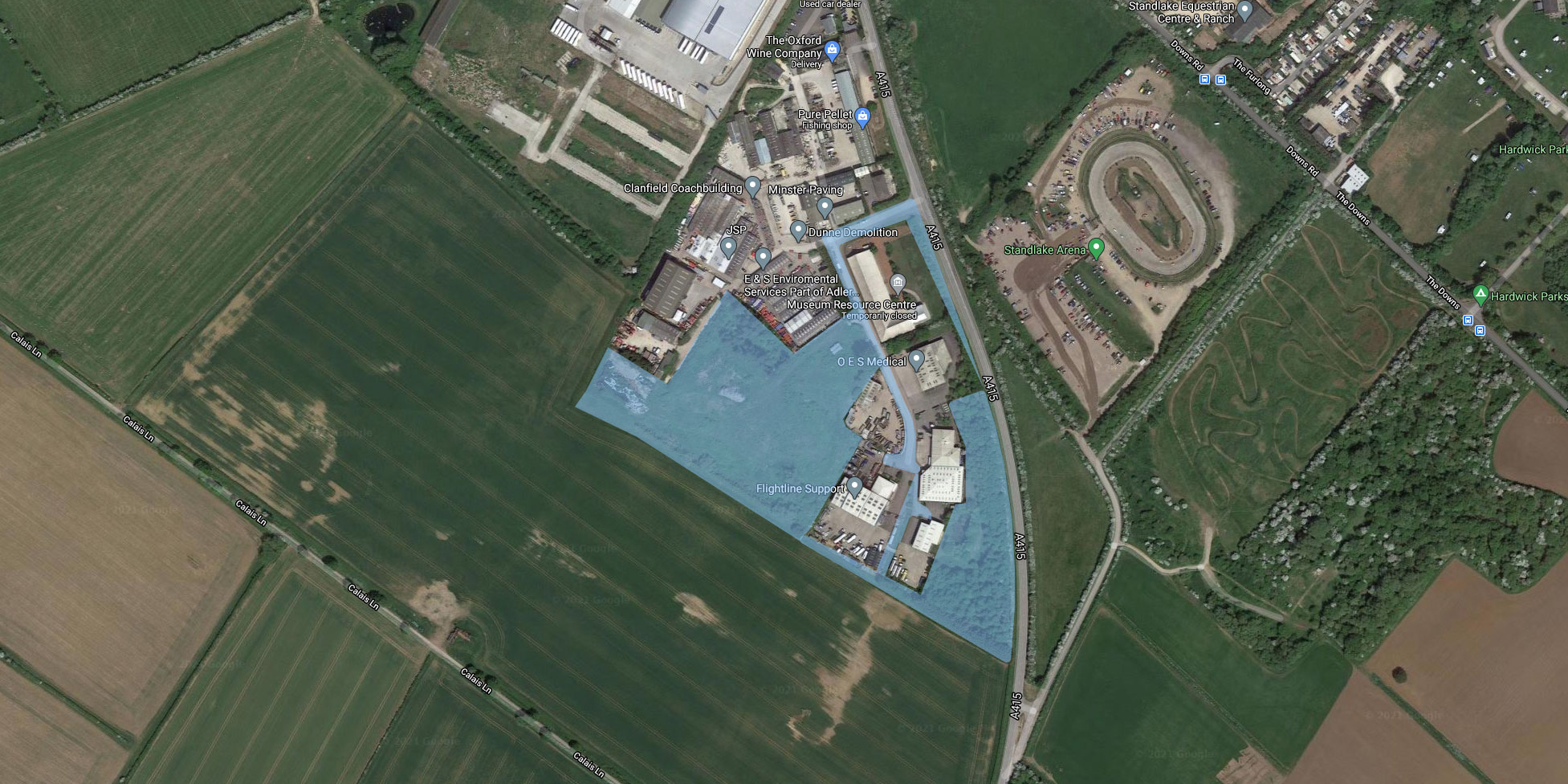
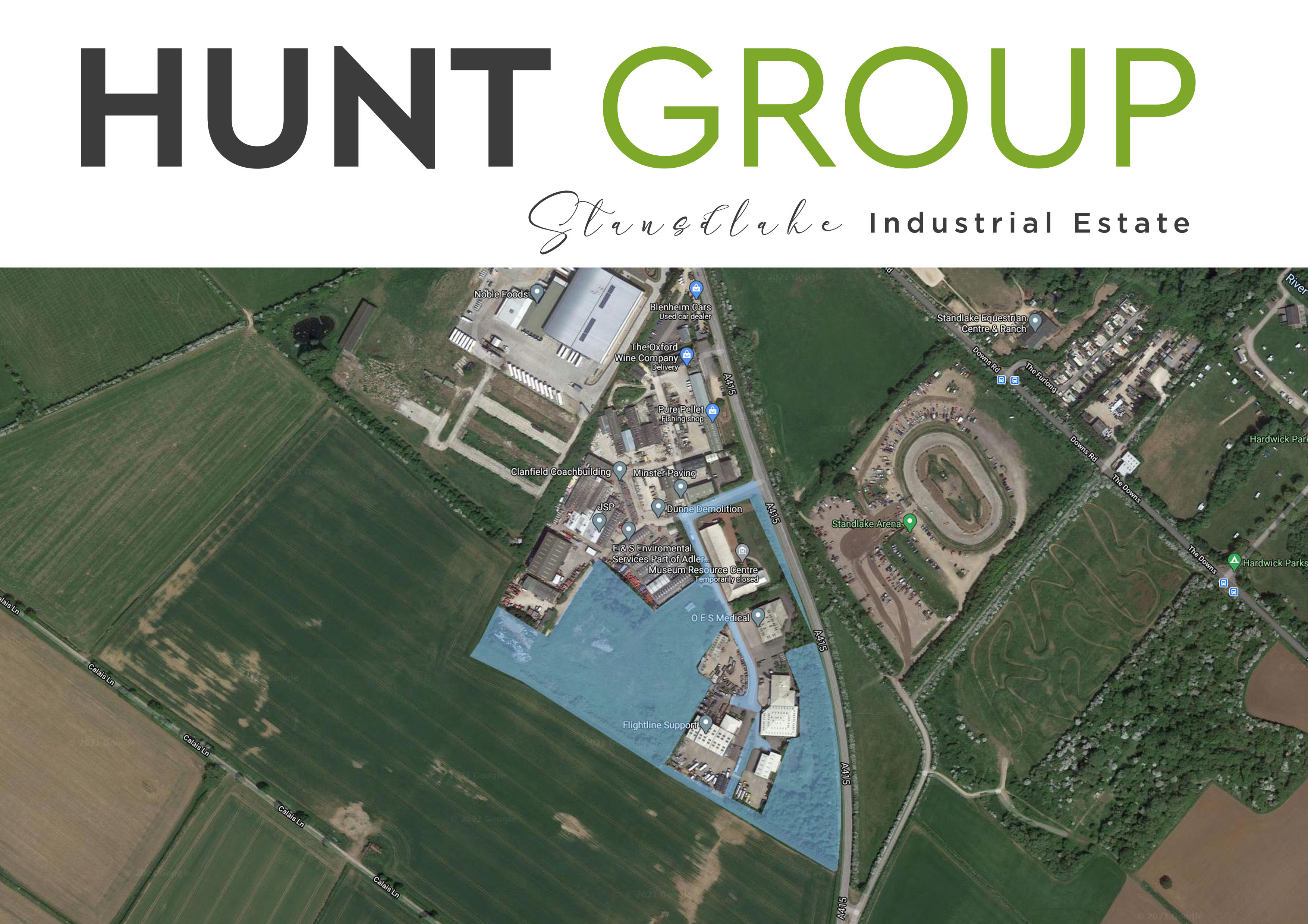
Delta-Simons Limited were instructed to undertake a Geo-Environmental Assessment for land off Cotswold Dene, Lakeside Industrial Estate Standlake, Witney OX29 7PL

It is understood that it is proposed that the Site will be developed to a commercial end use. The report has been produced to assess the risk for land contamination issues to be present at the Site in the context of the proposed development, to support the planning application and to provide a preliminary geotechnical assessment.

Site Setting:
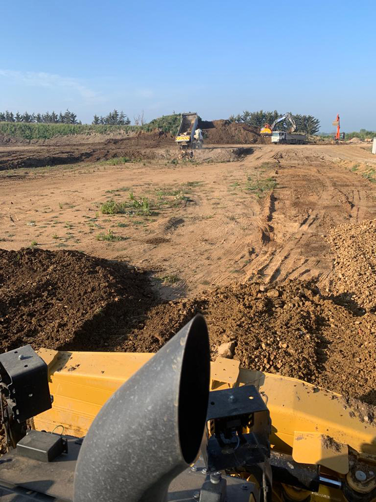
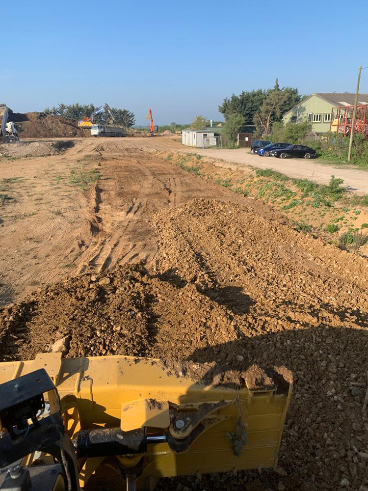
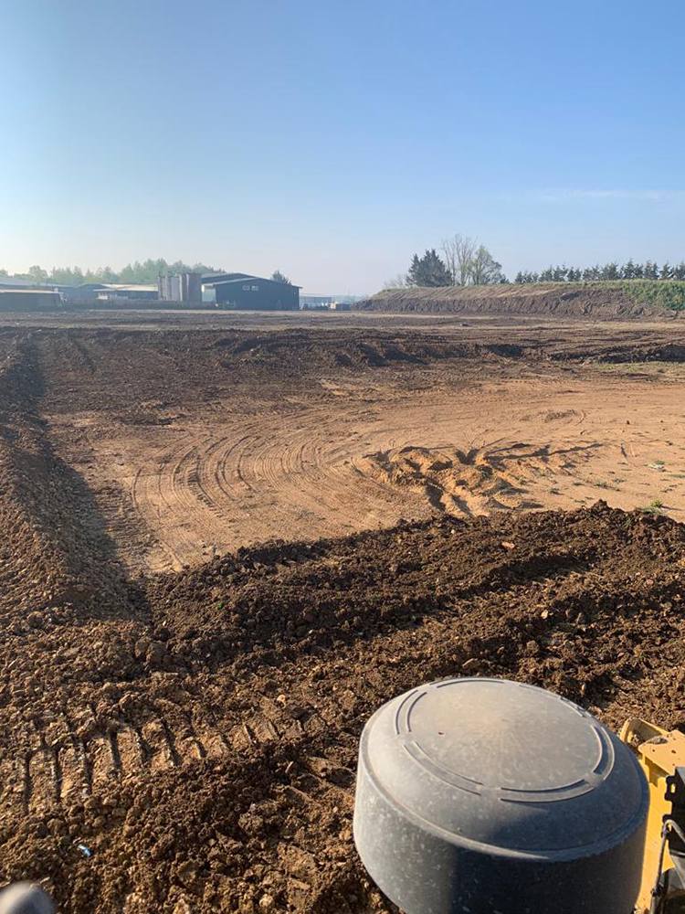
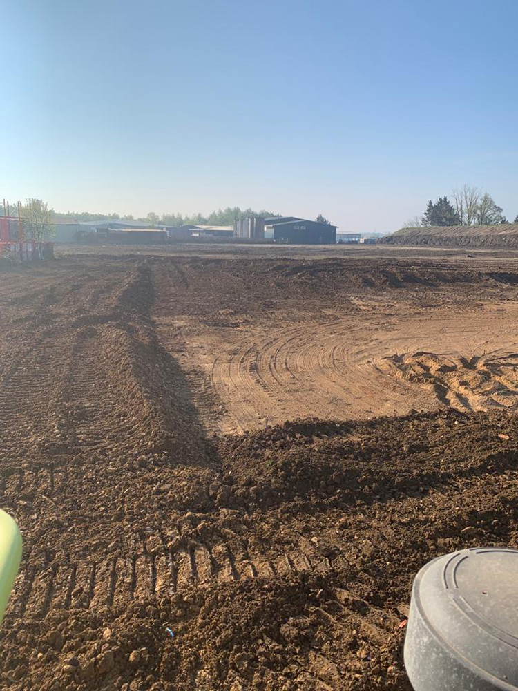
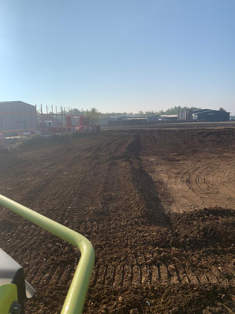
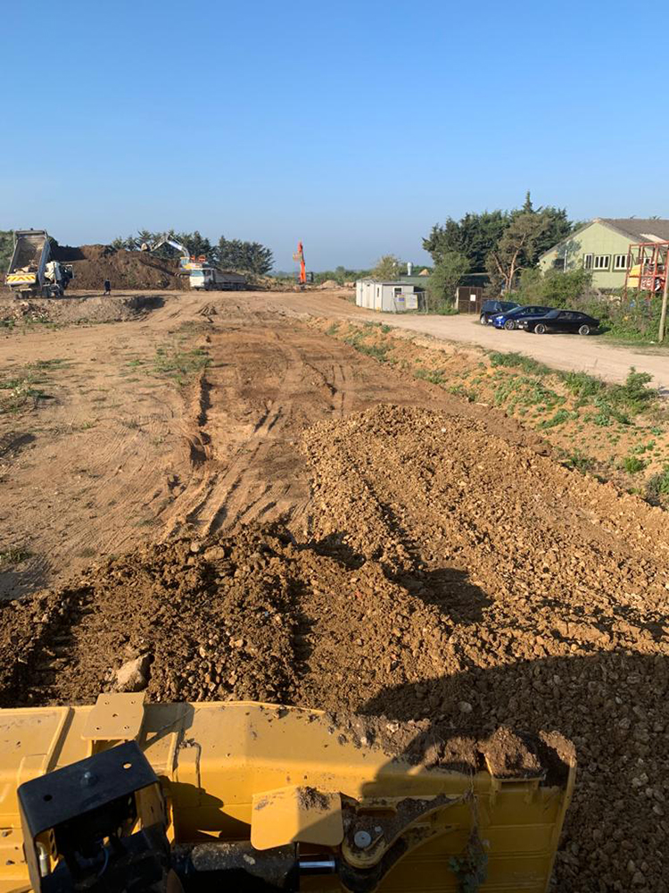
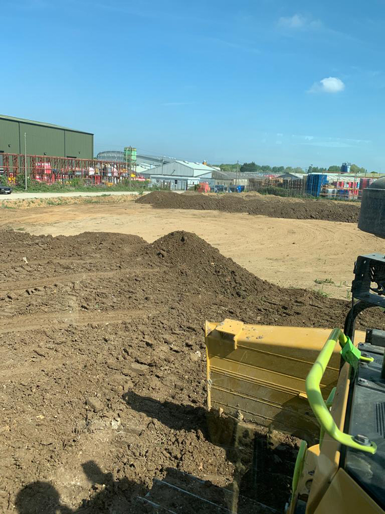
The Site is an irregular shaped area of land south of Cotswold Dene. The Site is currently unoccupied, consisting of a relatively flat, roughly vegetated area with a large stockpile located in the south, adjacent to the site boundary. Some areas of hardstanding remain from historic land use in the west of the Site.

Historic records show that the Site has remained mostly undeveloped with later use of the Site for stockpiling/storage. A former gravel pit was located in the southern extent of the Site and the area is characterised by a number of disused gravel pits, industrial land uses and former landfills. The Site underwent remediation / earthworks in 2021 with the removal of Made Ground up to 1.7m and replacement with backfill.

Land Contamination Assessment:
Significant soil contamination has not been identified that is considered to pose a risk to human health receptors in a commercial end use setting. Asbestos Containing Materials (ACM) have not been identified during this investigation. However, the presence of asbestos cannot be discounted within the Made Ground, particularly within historic Made Ground.

Elevated metals and sulphates were recorded in the underlying groundwater, considered to be indicative of background groundwater quality. Risks to controlled waters are considered to be low. Preliminary ground gas monitoring indicates the Site can be provisionally classified as CS2. It is recommended that supplementary ground gas monitoring and a revised assessment is undertaken to fully understand the ground gas regime for the Site.

Geotechnical Assessment:
Spread foundations extending to the underlying Summertown Radley Sand and Gravel Member may be considered to be a suitable foundation solution subject to further geotechnical testing. Care should be given to the presence of shallow groundwater when designing foundations. Where Made Ground is too deep or higher loads are required, then consideration of ground improvement of the Made Ground or piling into the bedrock deposits should be given.

Resting groundwater was noted to lie between 1.18 and 2.22 m bgl. Therefore, shallow groundwater maybe encountered within excavations and removal of these waters maybe required. Shallow Made Ground and groundwater at the Site have recorded elevated sulphates and as such, the conditions have been provisionally classified as Design Sulphate Class DS-5 for buried concrete.

View Phase 2 Geo-Environmental Report

Pre App 1

Town and Country Planning Act 1990 APPLICATION: 21/01951/PREAPP PROPOSAL:

To construct a small industrial site with units

AT: Land West Of Cotswold Dene Standlake

Policies: OS1NEW Presumption in favour of sustainable development

I write in regard to your enquiry received by the Council on the 28.05.2021 seeking the pre-application views of the Local Planning Authority. The relevant information is set out below. Please be aware of the disclaimer at the end of this letter. If you have any questions relating to the advice given, please contact the Case Officer.

Site Characteristics and Constraints:
The site adjoins the Standlake Industrial Estate within the open countryside accessed off the A415. The Industrial Estate lies to the North of the settlement of Standlake. The site has a history of contamination and drainage problems. The historic maps also indicate an area of archaeological importance in the area. A bridleway 360/8/10 runs to the south of the site.

Planning Assessment:
It is unclear whether the site forms part of the Standlake Industrial Estate but nevertheless appears to relate well to the existing employment buildings and defined southern boundary. Policy E1 of the adopted Local Plan supports the expansion of existing employment uses and as such, the principle of this development may be acceptable subject to compliance with other local plan policies.

Given its open countryside location, one of the main considerations will be the visual impact of the new industrial units which would be viewed from nearby roads and bridleway to the south. The submitted details indicate units with a ridge height of 7.2m which would be appear to be in-keeping with other buildings within the estate. Appropriate landscaping would help to soften and mitigate the impact of the development and would have ecological/biodiversity benefits. Any planting should be native and whilst it is recognised that there is some evergreen planting along the southern boundary, this should be re-inforced and replaced where necessary with appropriate woodland planting. The southern boundary is now quite exposed in places and in views from the south new industrial buildings are quite prominent. The mix of units is welcomed and the Council’s Business Development Manager agrees that there is a healthy appetite for such units.

The views of the County Council (OCC) have not been sought as part of this pre application response as they operate their own pre-application advice service and would comment on matters such as transport, drainage and archaeology. Their comments would be valuable in this respect as I understand that there is a routing agreement for HGV’s from the industrial estate and there have been drainage issues on the site. The historic maps also indicate an area on archaeological interest.

Please note that all applications should demonstrate a net gain in biodiversity where possible

Download

Pre App 2

Dear Sir, Town and Country Planning Act 1990

APPLICATION: 22/01989/PREAPP

PROPOSAL: 5 x Industrial units

AT: Lakeside Industrial Park Cotswold Dene Standlake

I write in regard to your enquiry received by the Council on the 18.07.2022 seeking the pre-application views of the Local Planning Authority. The relevant information is set out below. Please be aware of the disclaimer at the end of this letter. If you have any questions relating to the advice given, please contact the Case Officer.

Policies

  • OS1NEW Presumption in favour of sustainable development
  • OS2NEW Locating development in the right places
  • OS3NEW Prudent use of natural resources
  • OS4NEW High quality design
  • OS5NEW Supporting infrastructure
  • E1NEW Land for employment
  • T1NEW Sustainable transport
  • T2NEW Highway improvement schemes
  • T3NEW Public transport, walking and cycling
  • T4NEW Parking provision
  • EH2 Landscape character
  • EH3 Biodiversity and Geodiversity
  • EH7 Flood risk
  • EH8 Environmental protection
  • EH9 Historic environment
  • EH15 Scheduled ancient monuments
  • DESGUI West Oxfordshire Design Guide
  • NPPF 2021

Download

Work schedule for Oxford clearance

  1. 5x 21 ton excavators for eight months
    £650 each machine Per week Total per month £13000 x 9 = £117.000
  2. to Tele handlers
    350 a week Per month £2800 x 9 = £25200 Per month
  3. 2 x 30 ton dump trucks
    Each machine £700 Per week Per month £5600 x 9 = £50400
  4. 1 Warrior soil screener
    £1200 per week x 4 £4800 Per month x 9 £43200
  5. One 50 ton concrete crusher
    £1800 Per week x 4 = £ 7200 Per month x 9 = 64800
  6. One times D6 Komatsu bulldozer
    Per week £1600 x 4 = £6400 Per month x 9 = £57600
  7. 9 experienced machine drivers to operate crashes screeners diggers dumpers bulldozers and Tele handlers
    £220 Per day x 9 = £1988 x 6 days = £11.928 x 4 weeks = £47 712 Per month x 9 = £429.408
  8. 3000 L of diesel
    per day at 70p a litre = £2100 x 6 = £12600 x 4 weeks £50400 Per month x 9 = £453.600 These figures are to include travelling cost of nine people every day from Chessington to Oxford six days a week .

Total breakdown of cost for Labour and machinery clearing Oxford Site excluding disposal cost.
£1,304.208 million

Ground Clearance

For

Viewing

Please call:
Tom Amer

07810 652741

For

General Enquiries

Please call:
Richard Hunt

07721 333000

If you are

Interested

& would like more details.

Apply now

Contact us now

Call us for a chat, the virtual kettle is always on

or send us an email and we'll get back to you